
- This event has passed.
High Uintas Wilderness Service Week
**Please Note: This project is in the planning phase. Some details – including the specific dates – are subject to change. The project is expected to run (5) days, including up to (1) day of travel into and out of the wilderness at the outset and conclusion of the project. The project is scheduled to take place between Monday, August 17th and Friday, August 21st.
The Land
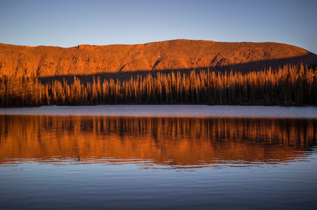
Located in northeastern Utah, the Uinta Mountains were named for the Uintaat Indians, early relatives of the modern Ute Tribe. The High Uintas Wilderness envelops the wild core of this massive mountain range. Characterized by the highest peaks in Utah, countless lakes, and a unique alpine ecosystem, it is among the nation’s most outstanding wilderness areas. The High Uintas Wilderness is administered jointly by the Ashley and Wasatch-Cache National Forests. The Uinta Mountains were carved by glaciers from an immense uplift of Precambrian rock. Some of this rock is exposed as colorful quartzite and shales. The main crest of the Uinta Mountains runs west to east for more than 60 miles, rising over 6,000 feet above the Wyoming and Uinta Basins to the north and south. Massive secondary ridges extend north and south from the crest of the range, framing glacial basins and canyons far below. This rugged expanse of peaks and flat-top mountains is the largest alpine area in the Intermountain West. Hundreds of picturesque lakes, streams, and meadows lie within sculpted basins. Cold, clear rivers plunge from the basins into deep canyons that form the headwaters of Utah’s major rivers. The Uinta Mountains rise from 7,500 to 13,528 feet at the summit of Kings Peak, offering diverse habitat for a wide variety of flora and fauna. Above treeline, tundra plant communities thrive in the harsh climate of the highest altitudes. Thick forests of Engelmann spruce, subalpine fir, and lodgepole pine blanket the land below treeline. These forests are interrupted by park-like meadows and lush wetlands. In the lower elevations, aspen groves and countless mixed species offer contrast to the scene. The Uinta Mountains are home to: elk, mule deer, moose, mountain goat, coyote, black bear, bighorn sheep, ptarmigan, river otter, pine marten, cougar, and 75 percent of Utah’s bird species, among many others. The High Uintas Wilderness boasts 545 miles of trail, which may be accessed from a number of trailheads surrounding the wilderness near the gateway communities of Duchesne, Roosevelt, and Kamas, UT and Evanston and Mountain View, WY. This extensive network of trails leads visitors deep into the wilderness, through thick forests, past rushing streams and placid lakes, to sweeping alpine vistas below majestic peaks. [from Wilderness.net]
The Work
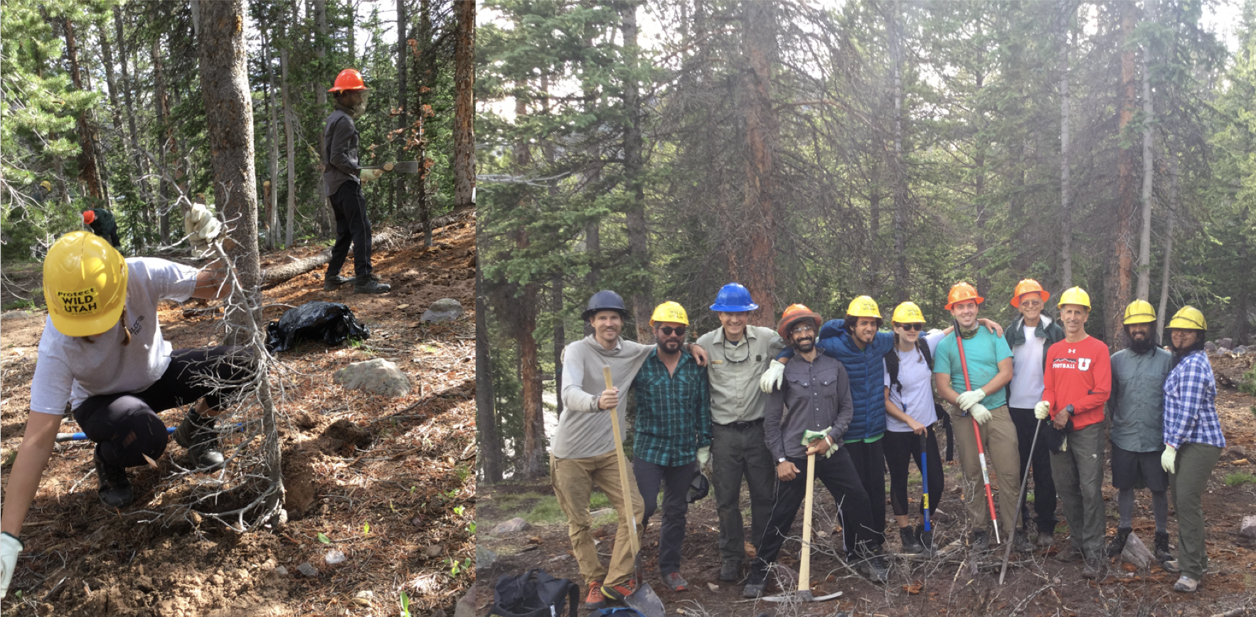
Since 2005 campfires and wood stoves have been prohibited with ¼ mile of nearly every lake within the Grandaddy and Four Lakes Basins. This regulation aims to protect the ecosystems and ecosystem services afforded by dead and downed woody debris adjacent to coastal areas, thus preserving the integrity of biotic communities and preventing erosion. Downed wood is important for animal and insect habitat, soil health, plant growth, and aesthetic quality and natural wilderness character. Many years of heavy campfire use and wood collection combined with slow rates of natural recovery have depleted this natural resource. Though informational flyers are posted at trailheads with clarifying information, additional work is required to maintain, upkeep and educate on impacts to the lake shore.
Work tasks will vary by need, and are slated to include:
- campsite compliance and clean-up;
- informational/educational signage installation;
- manual reclamation of visually disturbed surface/vertical mulching
 Our Objective: To improve on-the-ground conditions in high use areas in the High Uintas Wilderness. To remediate existing impacts resulting from nonpermitted camping.
Itinerary
A comprehensive itinerary will be provided to registered volunteers. Extensive hiking will take place at the beginning and at the conclusion of the project, with an anticipated 3-4 days of project work and camping. Details for the project will be finalized in June 2020.
Project Rating
Level 3 – Heavy lifting, high-elevation, remote travel, and extended durations away from common conveniences. Leave No Trace principles are essential during all of our trips but require the most thought and planning at Level 3. These trips may involve on-site training for technical skills and tool use. Excellent physical fitness is a must at this level.
Volunteer Responsibilities
Participants are responsible for their own food, water and camping gear as well as transportation to and from the project site(s). Volunteers should plan to be away from camp all day each of the work days. A recommended pack list will be sent along with the project Welcome Letter two weeks prior to the start date.
Registration
A Volunteer Agreement is required for this project.
When we have received your form, you will receive a confirmation e-mail within 5 working days of submission. The confirmation e-mail will indicate whether you have been placed on the “project roster” or a “waiting list.”
Three weeks before the start of the trip, you will receive an RSVP to confirm your participation. Individuals on the Waitlist will be contacted if spaces open due to cancellation.
Two weeks before the project start date, registered and confirmed participants will receive a Welcome Letter, with a comprehensive itinerary, including: driving instructions, a Project Map (for mobile devices), a notification about carpools and/or caravans, and additional information in a Pre-Departure email.
If you have any questions at any point throughout the process, please don’t hesitate to contact our program coordinator: volunteer@suwa.org or (435) 259-9151.
