Offers public only 30 days, including over the holidays, to submit comments on a plan that has been years in the making.
FOR IMMEDIATE RELEASE
Contact:
Laura Peterson, Southern Utah Wilderness Alliance, 801-236-3762, laura@suwa.org
Soren Jespersen, The Wilderness Society, 970-819-7377, soren_jespersen@tws.org
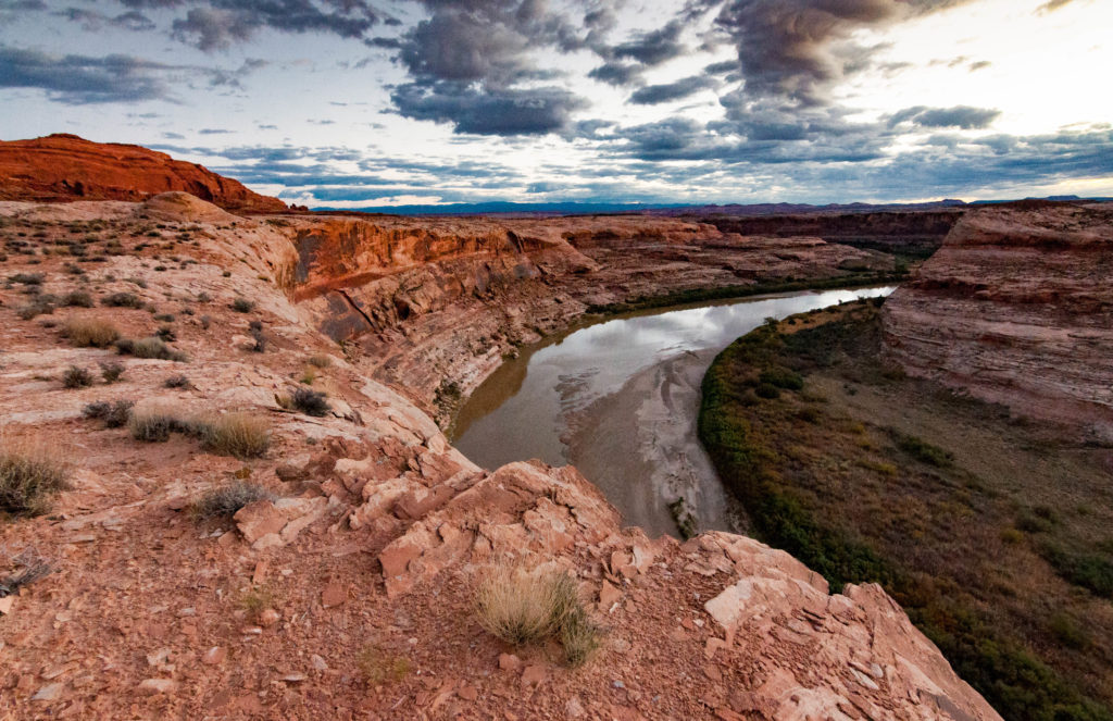
Salt Lake City, UT (December 16, 2019) – On Friday, December 13, the Bureau of Land Management (BLM) quietly released a draft travel management plan for the San Rafael Desert in Emery County, Utah that will forever change the area’s stunning and remote wild lands, turning it into a playground for off-road vehicles.
The San Rafael Desert travel plan is the first of thirteen travel plans that BLM will complete over the next six years as a part of a court-supervised settlement agreement with conservation and off-road vehicle groups. These thirteen travel plans will determine where motorized vehicles will be allowed in some of Utah’s wildest public lands, including the Dirty Devil, San Rafael Swell and Vermillion Cliffs.
The San Rafael Desert is a sublime area of Utah’s backcountry, encompassing the newly-designated Labyrinth Canyon Wilderness and wilderness-quality lands such as Sweetwater Reef and the San Rafael River. It features stunning redrock canyons, important cultural sites, and an outstanding diversity of native pollinators (bees and wasps). BLM’s draft plan would inundate this remote area with off-road vehicle routes, more than doubling the miles open to motorized vehicles from 300 miles to more than 775 miles.
“The BLM’s draft travel plan is short-sighted and wholly fails to account for the diverse array of public land resources and user groups,” said Laura Peterson, staff attorney at Southern Utah Wilderness Alliance. “Rather than capitalize on an opportunity to develop a reasonable, manageable and forward-thinking travel plan that ensures public access while preserving the backcountry and minimizing damage, the BLM’s plan does exactly the opposite. It proposes to designate any cow path, wash bottom and line on a map as open to off-road vehicles. The BLM’s plan would open popular hiking trails to motorized vehicle use. It would designate routes that will bisect wildlife habitat, fragment wild lands and damage important cultural sites.”
Federal law requires BLM to minimize impacts to natural and cultural resources when designating motorized vehicle routes. This includes minimizing damage to soils, watershed, vegetation, wildlife habitat, and cultural sites; minimizing the harassment of wildlife as well as conflicts between different public land user groups; and minimizing impacts of motorized vehicle routes on wilderness values like naturalness and solitude. BLM’s San Rafael Desert travel plan falls woefully short of meeting its legal obligation.
“BLM’s draft plan is as one-sided as they come,” said Soren Jespersen, Senior Field Representative at The Wilderness Society. “The plan would nearly double the amount of motorized roads and trails in the San Rafael Desert including by adding miles roads that do not exist on the ground today. This isn’t travel management, it’s a travel free-for-all, and it’s not what visitors to the San Rafael Desert come to experience.”
The BLM is giving the public only 30 days during the busy holiday season to review its proposed travel management plan and submit written comments.
More information, including maps and photographs of currently-designated and proposed motorized vehicle routes, is available here.
